A trench collapse on Fergusson Drive last spring shut down traffic for two days. The contractor had hit a lens of uncompacted river silt that gave no warning. In Upper Hutt, the Hutt River has spent thousands of years laying down interbedded gravels, silts, and organic clays across the valley floor. What looks like stiff gravel on a test pit wall can soften into slurry once the water table shifts. Our team deploys automated inclinometer strings, settlement plates, and piezometers before the first bucket goes in. We track lateral movement at the shoring face, pore pressure behind the wall, and vibration from compaction plant in real time. The data feeds into a dashboard the superintendent checks on a tablet. If a threshold trips, the crew gets a notification before a crack appears at street level. For basement excavations near the Trentham racecourse or pipeline trenches crossing the Silverstream floodplain, continuous monitoring turns guesswork into a controlled operation. We often combine the monitoring array with a CPT test profile to calibrate the target thresholds against actual soil stiffness, and we reference deep excavation design parameters when the cut exceeds 4 metres in mixed alluvium.
In Upper Hutt's river alluvium, a 5 mm movement measured at the inclinometer head today can mean a 25 mm crack in the footpath tomorrow.
Methodology applied in Upper Hutt
Critical ground factors in Upper Hutt
The risk profile changes dramatically between a steep cut in the alluvial fan gravels near Maymorn and a deep excavation in the soft silts of the Totara Park floodplain. Maymorn gravels drain fast and stand near-vertically for short periods, but they ravel without warning when drying out or subjected to vibration from passing trains on the Wairarapa Line. Totara Park silts hold water, creep slowly, and can lose bearing capacity under a shoring system if drainage is inadequate. The common failure mode in Upper Hutt is not catastrophic collapse but progressive deformation that damages adjacent footpaths, buried services, and shallow building foundations. A 10 mm settlement at the property line is enough to crack a brick veneer. That is why we set differential settlement alarms at 1:500 angular distortion across the monitoring array. The data also protects the contractor: it proves that movement existed before construction started, which is critical when neighbours in Pinehaven or Silverstream raise concerns about pre-existing cracks.
Our services
Our monitoring packages in Upper Hutt are built around the specific excavation geometry and ground conditions. We do not sell a one-size-fits-all sensor kit.
Inclinometer and ShapeArray monitoring
Automated vertical profiling of retaining wall deflection. Data streams to a cloud dashboard with configurable amber/red alarms.
Settlement and heave marker arrays
Precision levelling of surface monuments. Weekly reports with cumulative displacement plots referenced to a stable benchmark outside the zone of influence.
Piezometer and groundwater monitoring
Standpipe and vibrating wire piezometers to track pore pressure changes during dewatering and after rainfall events in the Hutt catchment.
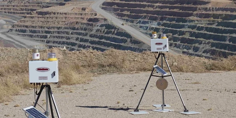
Vibration and noise monitoring
Triaxial geophones and Class 1 sound level meters for compliance with resource consent conditions near residential zones.
Frequently asked questions
What does geotechnical excavation monitoring cost in Upper Hutt?
For a typical residential or small commercial excavation in Upper Hutt, instrumented monitoring including inclinometer casing installation, settlement markers, and four weeks of readings generally runs between NZ$1,200 and NZ$3,720, depending on the number of instruments, reading frequency, and reporting requirements. A fixed quote is always provided after a site walkover.
When is excavation monitoring mandatory in the Hutt Valley?
Upper Hutt City Council typically requires monitoring as a resource consent condition when the excavation exceeds 2 metres depth and is within a distance equal to the excavation depth from a property boundary, road, or service. The NZGS guideline also triggers monitoring where the retaining structure is critical to public safety or where sensitive structures exist nearby.
How fast do you respond if an alarm is triggered?
The system sends an automated SMS and email within 60 seconds of a threshold breach. Our engineer on call reviews the data immediately and contacts the site supervisor to recommend action, which may be a visual inspection, reduced excavation rate, or temporary cessation until the cause is understood.